Ancient monuments, including three stone circles, eroded granite rock formations and industrial relics - all within one mile, at the south edge of Bodmin Moor
At the village of Minions, 5 miles north of Liskeard; PL14 5LE
The Hurlers and the Cheesewring are two elements of one of the most varied parts of Cornwall, along the south edge of Bodmin Moor - in an area less than 2 miles across are a granite tor topped by amazing eroded formations, of which the Cheesewring is the most photogenic, together with a series of ancient monuments including three stone circles (the Hurlers), a pair of standing stones, and the ramparts of a Bronze Age fortification, plus an assortment of industrial relics from the 19th and early 20th centuries, including an abandoned quarry, old tramlines, and the best preserved, an engine house from a disused tin mine.
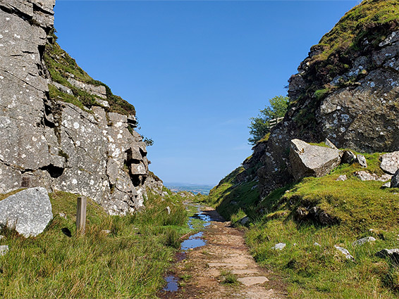
This region is known generally as the Minions, after the adjacent village by this name; the meaning of the term is not known but is first mentioned as long ago as 1613. The area is easily explored, crossed by plenty of paths; and the gradients are not at all steep; all the major sites can be seen on a loop walk of about 2 miles.
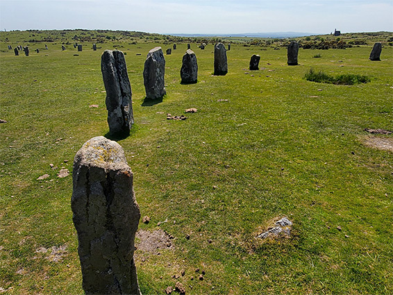
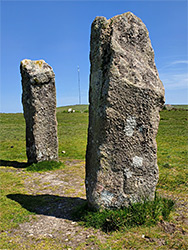
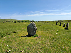
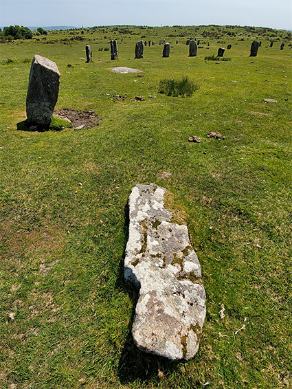
This part of Bodmin Moor is served by two car parks, designated Hurlers and Cheesewring - along the well-travelled road between Dobwalls and Upton Cross, either side of Minion village , where the facilities are a cafe and a few small shops. From the former parking place, a short walk northwest along a track first reaches the Pipers, a pair of standing stones, 15 feet and 13 feet tall, dating from the early Bronze Age, and almost certainly associated with the Hurlers stone circles - there are three circles, the closest 260 feet east. The name, relatively modern, is based on a legend that the stones are the petrified remains of men who were punished for playing hurling on a Sunday, and similarly, the Pipers are a pair of musicians, also turned to stone for performing on the Sabbath.
The close, linear grouping of the three Hurlers circles is unique in the UK. The northern circle has 15 visible stones and ten buried, while the central circle, the best preserved, has 14 visible and 14 buried. The southern circle is the least well preserved and has never been excavated; it has nine visible stones, most of which are fallen. Other circles also have some fallen stones, a situation exacerbated by the introduction of cattle in the last few decades, who use the stones to rub against.
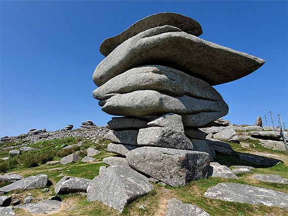
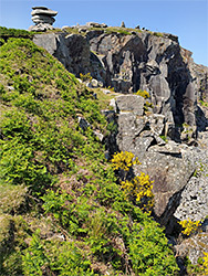
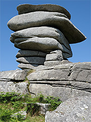
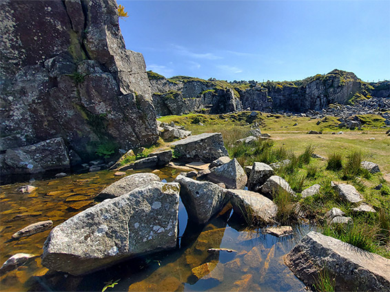
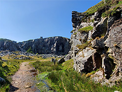
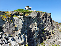
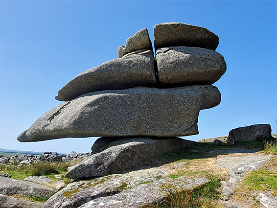
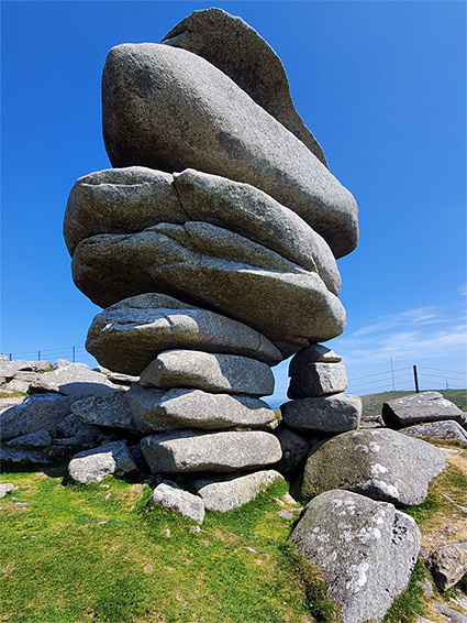
North of the circles, the land slopes gently up towards the Cheesewring Quarry, used for extraction of granite, beginning in 1845 and largely finished by the early 20th century though sporadic excavations continued until 1984. At its peak, the complex included a railway, various service buildings, and a row of quarryman's cottages, all now removed. The quarry is sited just southeast of Stowe's Hill, a 1,249 foot tor, the top of which is dotted with eroded granite mounds; most famous is the Cheesewring, which resembles a stack of huge flat boulders. The formation is entirely natural, and has a scenic position right on the quarry rim, prominently visible from below. Also on the hill is Stowe's Pound, a pair of Bronze Age stone enclosures, protecting a series of other ancient structures including two cairns and many house platforms.
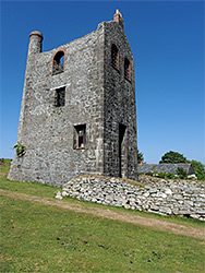
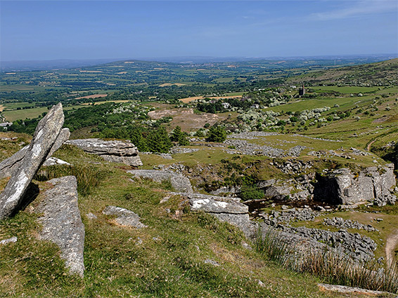
A little way southeast of the quarry is the size of Phoenix Union Mine, a tin and copper operation, in use from 1836 to 1914. Again this was a substantial complex, with many shafts, adits, tracks and buildings, but most is now disappeared - the main remnant is the engine house of the South Phoenix Mine, restored and currently housing an information center with exhibits about the history of the mine. Heavy metal contamination of a surrounding soil has restricted growth of typical plants and instead allowed mosses, lichens and liverworts to flourish, on account of which the area is a Site of Special Scientific Interest.