Rocks underlying the Quantock Hills in west Somerset are sedimentary, from the Devonian period, a mix of sandstone, slate and shale, though are exposed in only a few places; most of the range is covered by fields, moorland and woods, and the topography is relatively gentle, lacking any dramatic peaks. The hills, a band of farmland at the base and a three mile section of the Bristol Channel coastline, between Kilve and St Audrie's Bay, make up the 38 square mile Quantock Hills Area of Outstanding Natural Beauty, the earliest designated such region, established in 1956.
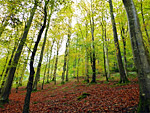
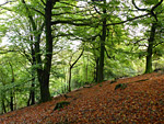
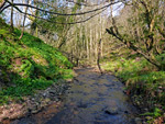
The hills are quite a narrow range, two to three miles across and ten miles in length, with a high point at 1,261 foot Wills Neck towards the southern end, one of ten significant summits along the central ridgeline. To the southwest, the ground slopes quite steeply and is split by a dozen or more narrow, treeless combes, usually dry, while the northeast-facing side angles down more gradually, and is drained by longer valleys with flowing streams; Hodder's Combe is probably the most photogenic. Here, the land is generally more tree-covered, especially one large block at the centre, 3 miles across, of which about half is ancient oak and birch woodland, the remainder conifer plantations (fir, pine and spruce), established at the end of the 18th century.
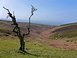
Vehicles can drive along most of the ridgeline, and nearly all the valleys and ridges are followed by tracks and paths, so the hills as a whole are very easy to access and explore, and often quite busy, so do not offer not the same sense of solitude as is possible on Dartmoor and Exmoor for example, but the higher reaches do have plenty of open, unfenced moorland, with spectacular views in all directions.
LandscapesCockercombe and Triscombe Stone Wooded valleys in the Quantock Hills, and a section of the ancient ridgeline path Rating: ★★★★★ |
| Hodder's Combe and Beacon Hill Wooded valley and a 1,018 foot summit overlooking the Bristol Channel; in the northern half of the Quantock Hills Rating: ★★★★★ |
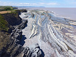
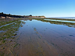
| Lilstock to St Audrie's Bay Four mile stretch of the coast, including Kilve Pill and Quantock's Head, with layered, blue lias cliffs above extensive, wave-cut terraces Rating: ★★★★★ |
| Watchet to St Audrie's Bay Three mile stretch of the coast, with layered cliffs, pebble banks, wave-cut terraces, sand/mud beaches and a moss-lined waterfall Rating: ★★★★★ |
Nature ReservesAisholt Wood Broad-leaved woodland across a north-facing slope at the end of a ridge on the east side of the Quantock Hills, bordered by a stream Rating: ★★★★★ |
| Holford Kelting Streamside vegetation and ancient deciduous woodland on the east side of the Quantock Hills Rating: ★★★★★ |
